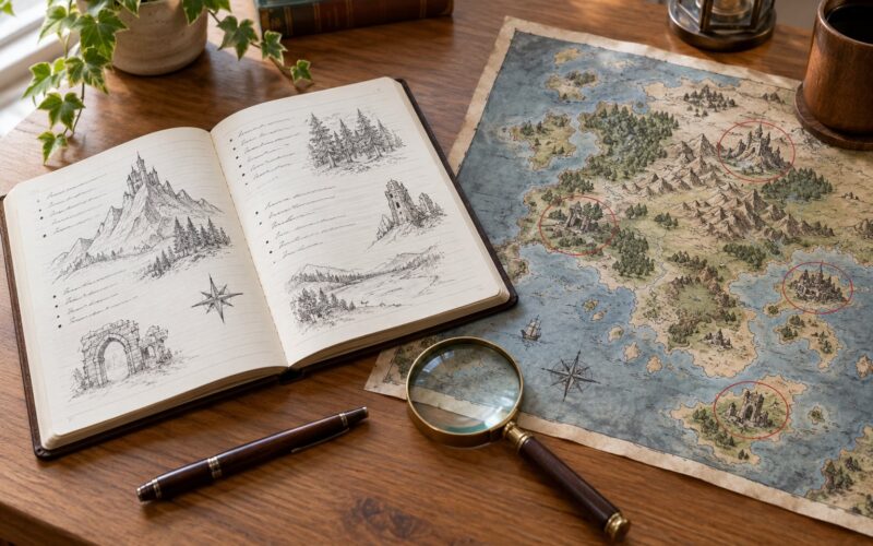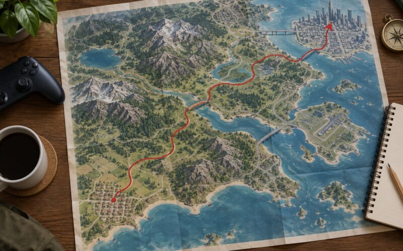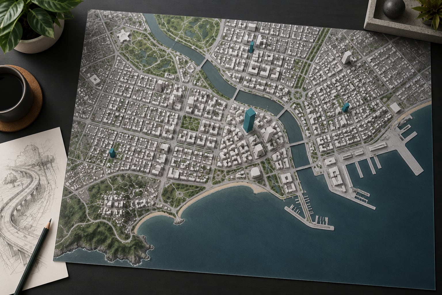
How city maps are built in open world games is a layered data problem, not a modelling problem. A designer plans districts and landmarks, blocks the city out as plain grey geometry, lays a road graph, splits blocks into lots, drops modular building kits onto those lots, dresses them with props, then layers population and traffic on top. The finished world is streamed in chunks so only the nearby cells are ever loaded.
Every open world city you have driven through was assembled in roughly that order, whether the team was three people or three hundred. The order matters more than the tools, because it is what keeps a map from collapsing into a grid of grey boxes with nothing to do.
Table of Contents
- 1What Is the Role of a City Map in an Open World Game?
- 2The city map is data, not scenery
- 3How City Maps Are Built in Open World Games
- 4The nine-step pipeline
- 5The design map is not the playable map
- 6Hand-built districts versus procedural ones
- 7How Do Developers Plan the City’s Scale and Layout?
- 8Pick a real-world scale first
- 9Use landmarks as wayfinding
- 10How Do Terrain, Water and Coastlines Shape the Map?
- 11How Are Roads, Intersections and Traffic Networks Created?
- 12Laying the road graph
- 13Keeping traffic from gridlocking
- 14How Do Buildings and Districts Get Placed?
- 15Modular kits and kitbashing
- 16Interiors are separate worlds
- 17How Do NPCs, Vehicles and Activities Fill the City?
- 18How Do Developers Test and Optimize an Open World Map?
- 19How Does a Small Mod Map Differ from a Full Game City?
- 20Tools modders actually use
- 21Frequently Asked Questions
- 22How are game maps created?
- 23How do I build a city map for my own game?
- 24Do open world games use real world maps?
- 25How long does it take to make an open world game map?
- 26What is the biggest open-world game map ever made?
- 27Can I use OpenStreetMap data to build a game city?
- 28Conclusion
What Is the Role of a City Map in an Open World Game?
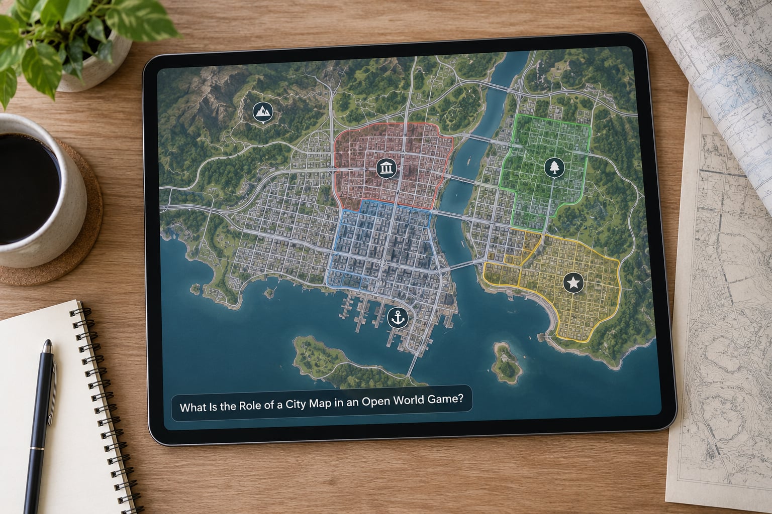
A city map is the playable foundation that holds locations, roads, districts, activities, progression and exploration together. It decides where the player can go, what they find there and how long the trip takes, which means map design sets both the freedom of the sandbox and the size of the production schedule behind it.
The city map is data, not scenery
Newcomers usually picture a map as a big model of buildings. That is the last three percent of the job. Most of what a city map actually is lives in data: spline curves for roads, a list of lots, rules that say which kit piece may sit on which lot, a navigation mesh that pedestrians walk on, and spawn points attached to activity types.
That distinction is why a hand-built city can be a few hundred artists’ assets but millions of placed instances. The art is reusable; the placement is specific.
| Layer | What it holds | Who owns it | Built when |
|---|---|---|---|
| Terrain and water | Heightmap, rivers, coastline, beaches | Environment art and world design | First, before anything sits on it |
| Road network | Road splines, junctions, lanes, bridges | Level design | Early, once terrain settles |
| Zoning and lots | District rules, block subdivision, building footprints | City design | Alongside the road plan |
| Modular buildings | Kit pieces assembled into façades and interiors | Environment art | After the blockout is proven |
| Set dressing | Props, foliage, signage, clutter, decals | Level art | Once the shapes are right |
| Gameplay | POIs, missions, shops, garages, checkpoints | Design and gameplay | Once a district is walkable |
| Simulation | Traffic, pedestrians, patrols, economy | Engineering and AI | Last, on top of a finished shape |
How City Maps Are Built in Open World Games
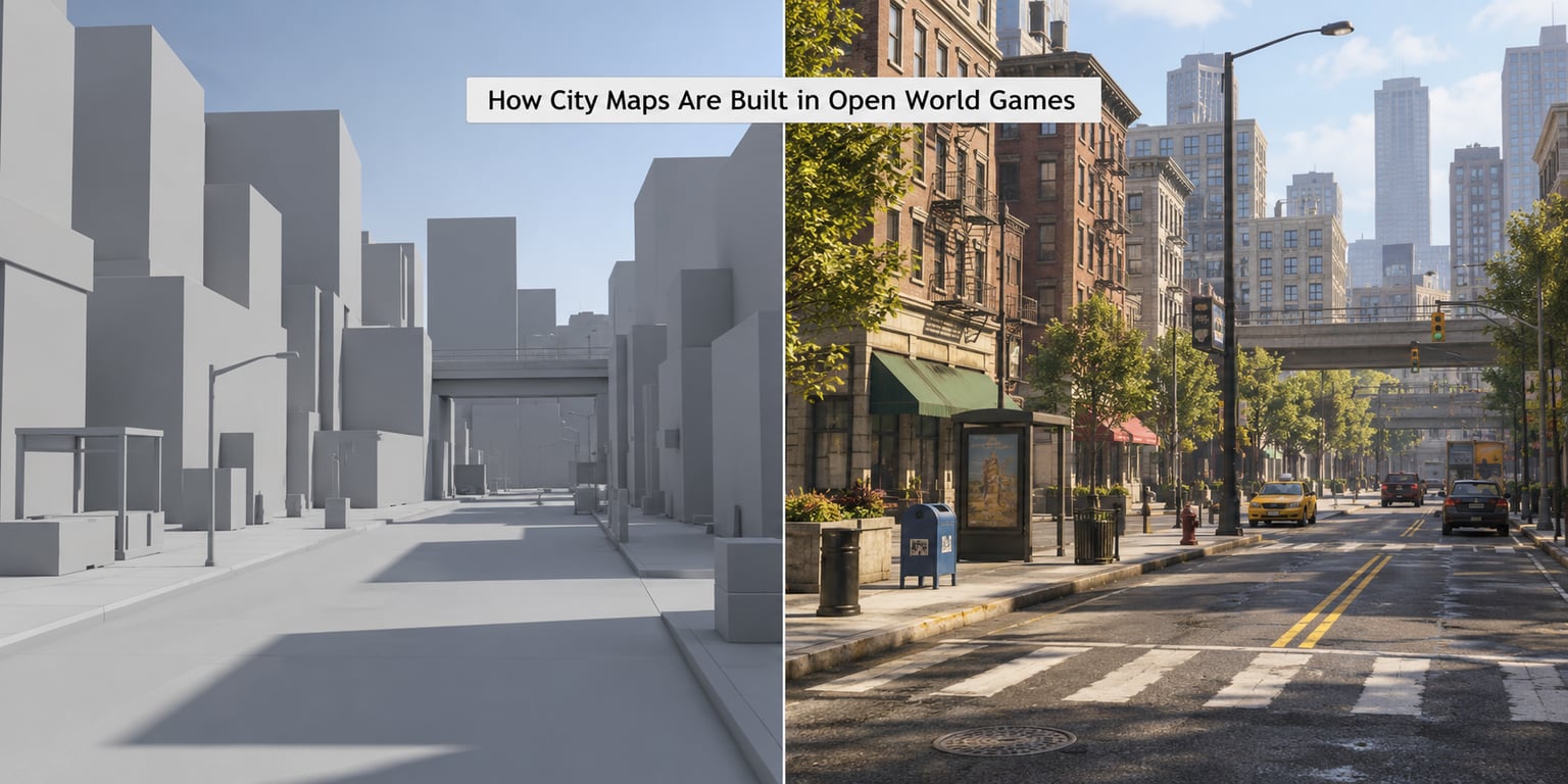
The build runs in a fixed order: concept and scale first, then a grey blockout, then roads, zoning and lots, then modular buildings, then props and landmarks, then navigation and simulation, then streaming and optimization, then playtesting. Teams jump backward constantly, but almost never forward past a stage that has not been playtested yet.
The nine-step pipeline
- Pick a real-world scale and decide the map’s playable area in square kilometres.
- Write the district plan: how many districts, what each one is for, and where they sit.
- Choose landmark anchors that players will use for navigation long after names are forgotten.
- Block out the city as untextured grey massing to test scale, sightlines and travel time.
- Lay the road graph, then subdivide each block into lots and assign zoning rules.
- Place modular kit pieces onto lots, then fill facades and interiors with kitbashed variants.
- Dress streets with props, foliage, signage and lighting to break repetition.
- Bake the navigation mesh and set traffic, pedestrian and spawn rules on top of it.
- Stream the world in chunks, then playtest traversal, performance and unfinished areas.
Steps one through three are cheap and wrong-able. Steps six and seven are where the money goes. If the grey massing in step four feels boring, no amount of prop work rescues it, which is why good teams refuse to move past blockout until someone has driven the layout.
The design map is not the playable map
Designers draw a clean diagram with tidy district boundaries and short labels. The playable world is that diagram at ground level, where the label downtown is a two-hour drive from the starting point and the river you drew as one neat curve turns out to have four bridges on it. Both maps have to be true at once, and they never match perfectly.
Hand-built districts versus procedural ones
Most shipped cities are a mix, and the argument between the two approaches is really about where the repetition lives.
| Factor | Hand-built district | Procedurally generated district |
|---|---|---|
| Control | Total; the designer decides every corner | Rules decide, designer sets the rules |
| Production time | Slow per district, scales with people | Fast to fill kilometres of land |
| Uniqueness | Every block can be different | Repetition is the failure mode players notice |
| Iteration cost | Expensive to change after art lands | Cheap to re-roll, expensive to art-direct |
| Narrative fit | Easy to stage a story in a known place | Harder to guarantee a good set piece |
The complaint you see most often from players, and from developers reading their own playtests, is that procedural cities look samey. Randomising the order of the same building library produces variety in arrangement but not in shape, and players read that as fake within minutes.
How Do Developers Plan the City’s Scale and Layout?
Scale comes first because everything after it inherits the choice. Pick a real-world reference, decide how much of the city is playable, and check that the numbers hold at walking speed and at driving speed.
Pick a real-world scale first
Teams usually anchor the map to something honest, such as a real district compressed, or a real city with the outer ring trimmed. Compressing distances is a legitimate trick, but it has a limit: when two narrative locations that should be an hour apart sit four minutes apart, immersion breaks. That compression problem is the single most common design complaint aimed at modern open worlds.
Test the layout by timing it. A district that reads as fifteen minutes of driving on the map can be four minutes in an average car, and the fix is usually distance or a deliberate traffic jam, not a bigger number on the map screen.
Use landmarks as wayfinding
Players navigate by silhouette. A tower, a stadium, a refinery stack or a suspension bridge visible from three districts away does more work than a full street-sign system, and it costs one asset instead of ten thousand.
Place anchors so that each district has one visible from its neighbour, then check the sightlines in the blockout. If two anchors overlap from the main road, one of them is wasted art budget.
How Do Terrain, Water and Coastlines Shape the Map?
Terrain decides the map before anyone draws a road. Heightmaps built in a landscape tool define where the city can and cannot go, and the coastline is the cheapest large-scale boundary a designer can have.
Flat ground suits grids, which is why most dense downtowns are drawn on plain terrain with the slopes pushed out to the edges. Hills and rivers do the opposite: they break the grid, force bridges, and give districts a natural identity.
Water also acts as a hard barrier. A harbour, a lake or a cliff line saves the team from building a wall and gives the player a clear mental edge for the map. Coastlines with beaches are more expensive because sand, tide lines and access routes all need art and collision.
How Are Roads, Intersections and Traffic Networks Created?
Roads are curves first and geometry second. A road spline carries lane count, width, surface type and speed limit, and the mesh is generated along it. Intersections are authored objects that stitch splines together and define who has right of way.
Laying the road graph
Start with arterials that connect the landmarks, then hang local streets off them, then add the awkward connectors: on-ramps, tunnels, bridges over water and rail crossings. Every one of those is a collision and pathfinding problem later, so they get reviewed early rather than discovered in play.
Lane layouts matter more than they look. Traffic simulation reads lane direction and connection data, so a mis-signed lane produces vehicles that turn against traffic or sit in a junction forever.
Keeping traffic from gridlocking
Traffic density is tuned against the road graph, not by taste. Too many vehicles on a two-lane road turns a main street into a parking lot, and players blame the map even though the map is fine.
Three failures show up in almost every playtest: routes that dead-end at a barrier, intersections where two busy roads meet without a light, and shortcuts that let a player cut through a district faster than the design intends. The last one is fixed with geometry, not rules, and it is cheaper to fix during blockout.
How Do Buildings and Districts Get Placed?
Buildings start as footprints. The blockout team draws boxes at the right scale and height so designers can judge massing, then the art team replaces them with modular kits that snap to those footprints.
Modular kits and kitbashing
A modular kit is a small set of pieces designed to connect: a bay of facade with a fixed window spacing, a corner piece, a ground-floor shopfront, a rooftop unit. Because every piece shares dimensions, one kit covers hundreds of buildings, which is how a city of thousands of structures stays affordable.
Kitbashing is the art of combining pieces across kits and kitsbashed sets so no two facades read identically. A cornice from an industrial kit on a 1920s office block is cheap, invisible to most players, and the reason a street does not feel stamped out.
Interiors are separate worlds
Anything the player enters gets built at a different standard. Interiors need doors that work, rooms that match the exterior footprint, and lighting that matches the time of day outside. Many teams build exteriors years ahead of interiors, then discover that a promised hideout has no back wall.
Zoning ties it together: rules assign each lot a type, and each type decides which kits, heights and prop sets are allowed. Changing a district from commercial to industrial then becomes a rule edit rather than a rebuild.
How Do NPCs, Vehicles and Activities Fill the City?
The finished geometry does nothing on its own. A navigation mesh tells pedestrians and cops where they can walk, spawn rules decide when an agent exists, and activity anchors decide what each corner of the map is for.
Agents are spawned when the player is near and despawned when they are not, so a whole city of pedestrians costs only what the streaming system has loaded. Missions, shops, garages, hideouts tucked beside them and checkpoints are placed deliberately, usually a drive apart, so travelling between them has something to look at.
Population is a dial, not a constant. Too dense and the city feels alive but unplayable; too sparse and streets read as empty at night. Most teams tie density to time of day and district type, which is also how they make the same blockout feel different between a noon drive and a midnight one.
How Do Developers Test and Optimize an Open World Map?
Testing an open world is mostly about two questions: can the player get anywhere, and does the machine survive the attempt.
Traversal playtests are done on foot first, then by vehicle, then by every vehicle class the game has. Designers log where a player got stuck, where they got lost and where they simply turned around because the map had nothing to show them.
Technical testing covers frame rate in the heaviest district, memory use after long travel, loading times when crossing a chunk boundary, draw calls with a full street in view, and traffic density on the worst-case road. If a streamed world stutters while a helicopter flies over downtown, the stutter is the bug, not the city.
Unfinished-area checks are unglamorous and essential: search the map for untextured surfaces, missing collision, placeholder props and doors that open onto nothing. Shaders can catch some of this automatically, and artists can catch the rest faster than any tool.
Real developers report that performance, not content, is what takes longest to fix in an open world. That matches what most teams say out loud: the world is finished when it holds frame rate, not when the last building is textured.
How Does a Small Mod Map Differ from a Full Game City?
A mod map inherits everything the base game already built: the engine, the streaming rules, the traffic system and the file budget. That constraint is the whole difference. A shipped city is designed and tested over years, and a custom map has to fit inside structures that were not designed for it.
Scope is the first casualty. A district that looks modest in a top-down screenshot can be three or four times the work once entrances, interiors, collision and traffic routes are handled. Most mod maps that fail, fail at the interiors and the entrances rather than at the skyline.
Tools modders actually use
Mapping editors built for existing games handle the geometry, and the underlying engine handles lighting, traffic and streaming through those editing tools. Real-world data is a common starting point: roads, building footprints and elevation from OpenStreetMap can be imported, cleaned up by hand, and used as a reference rather than shipped as-is, since the raw data has no game-ready geometry.
Collision is the other recurring problem. Anything a player can stand on needs collision that matches what they see, and getting that right without engine access is where most custom maps run into trouble. Compatibility matters too, because a map built for one game version can break on the next patch if the mod tools changed.
Our advice for anyone starting: build one block, make it fully enterable, and get that single block running at frame rate before planning a district. It is much less discouraging than finishing a skyline and then discovering the interiors will not load.
Frequently Asked Questions
How are game maps created?
Game maps are created in layers, in a fixed order. Designers plan scale and districts, block the city out as plain grey massing, lay the road network, subdivide blocks into lots, place modular building kits, dress the streets with props, then add navigation, traffic and gameplay. Streaming and optimization come last, and the whole map is playtested on foot and by vehicle before detail art lands on it.
How do I build a city map for my own game?
Start with one small district rather than a whole city. Fix your scale in real-world terms, pick two or three landmarks, block out grey massing and drive it to check travel time. Then lay roads, split blocks into lots, build a small modular kit and place it. Add entrances, interiors, props and traffic last, testing frame rate as you go.
Do open world games use real world maps?
Most use real geography as a reference rather than as final assets. Cities like Los Santos or Liberty City are recognisable but are compressed, relocated and simplified so that travel times suit the game. Studios also pull real elevation data and road layouts as a starting point, then redraw them by hand, because raw map data carries no game-ready geometry or collision.
How long does it take to make an open world game map?
There is no useful single number, because a playable grey-box city and a finished one are different projects measured in different units. A small open world can reach a playable state in months with a handful of people. A large one is a multi-year effort, and developer reports consistently say the time goes into performance, streaming and interiors rather than into the skyline.
What is the biggest open-world game map ever made?
The Elder Scrolls II: Daggerfall is usually cited for sheer land area, at roughly the size of Great Britain, and Morrowind was famously trimmed to a small fraction of that. Modern maps like Red Dead Redemption 2 or GTA V are physically smaller but denser, because they pack more buildings, interiors and activities into each square kilometre.
Can I use OpenStreetMap data to build a game city?
You can use it as a reference or a starting point. Roads, building footprints and elevation are all available and many people build game versions of their own hometown from them. The raw data still needs manual cleanup, and you will have to generate geometry, collision and traffic connections yourself before any of it becomes playable.
Conclusion
Open world cities are built in a fixed order: scale and districts, grey blockout, road graph, zoning and lots, modular buildings, set dressing, navigation and simulation, streaming, then playtesting. Teams that skip ahead to art spend their budget fixing shapes, and teams that skip the blockout end up designing a city nobody could walk.
If you want to try this yourself, do one thing first. Fix the map’s real-world scale, choose three landmarks players can see from a distance, block the layout out in plain grey boxes and drive it end to end. Everything after that step, roads, kits, props, traffic, is a refinement of a layout you have already proven works. And if you play open worlds more than you build them, knowing how city maps are built in open world games is a handy way to read a map like a designer. When a district feels believable, ask which landmark is guiding you and which kit the facades are drawn from. When a city feels samey, look for repeated pieces and procedural blocks. That is all it is: layers, in an order, chosen on purpose. This guide was refreshed for 2026.